The state lies at a latitude of 23°83'N – 25°68'N and a longitude of 93°03'E – 94°78'E. The total area covered by the state is 22,327 square kilometres . The capital lies in an oval-shaped valley of approximately 700 square miles surrounded by blue mountains and is at an elevation of 790 metres above sea level The slope of the valley is from north to south.
The mountain ranges create a moderated climate, preventing the cold winds from the north from reaching the valley and barring cyclonic storms.The state is bordered by the Indian states of Nagaland to its north, Mizoram to its south, Assam to its west, and shares an international border with Myanmar to its east.
A tree amid Manipur hills.
The state has four major river basins: the Barak River Basin Barak Valley to the west, the Manipur River Basin in central Manipur, the Yu River Basin in the east, and a portion of the Lanye River Basin in the north.
41 The water resources of Barak and Manipur river basins are about 1.8487 Mham. The overall water balance of the state amounts to 0.7236 Mham in the annual water budget.By comparison, India receives 400 Mham of rain annually.
The Barak River, the largest of Manipur, originates in the Manipur Hills and is joined by tributaries, such as the Irang, Maku, and Tuivai. After its junction with the Tuivai, the Barak River turns north, forms the border with Assam State, and then enters the Cachar Assam just above Lakhipur. The Manipur river basin has eight major rivers: the Manipur, Imphal, Iril, Nambul, Sekmai, Chakpi, Thoubal and Khuga. All these rivers originate from the surrounding hills.
Almost all the rivers in the valley area are in the mature stage and therefore deposit their sediment load in the Loktak lake.The rivers draining the Manipur Hills are comparatively young, due to the hilly terrain through which they flow.
These rivers are corrosive and assume turbulent form in the rainy season. Important rivers draining the western area include the Maku, Barak, Jiri, Irang, and Leimatak. Rivers draining the eastern part of the state, the Yu River Basin, include the Chamu, Khunou and other short streams.
Manipur may be characterised as two distinct physical regions: an outlying area of rugged hills and narrow valleys, and the inner area of flat plain, with all associated landforms. These two areas are distinct in physical features and are conspicuous in flora and fauna.
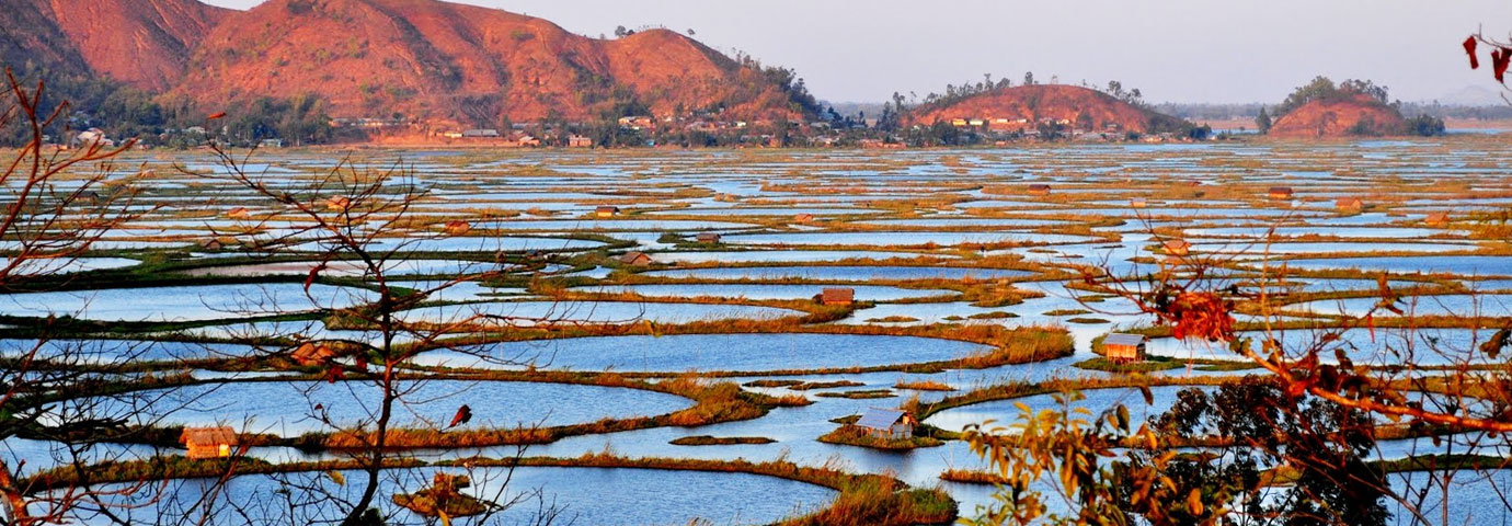
The valley region has hills and mounds rising above the flat surface. The Loktak lake is an important feature of the central plain. The total area occupied by all the lakes is about 600 km2. The altitude ranges from 40 m at Jiribam to 2,994 m at Mt. Iso Peak near Mao Songsong.
The soil cover can be divided into two broad types, viz. the red ferruginous soil in the hill area and the alluvium in the valley. The valley soils generally contain loam, small rock fragments, sand, and sandy clay, and are varied.
On the plains, especially flood plains and deltas, the soil is quite thick. The topsoil on the steep slopes is very thin. Soil on the steep hill slopes is subject to high erosion, resulting in gullies and barren rock slopes. The normal pH value ranges from 5.4 to 6.8.
No comments:
Post a Comment